Marine Protected Areas (MPAs) play a critical role in conserving biodiversity and supporting sustainable ocean management. Effective monitoring of these areas requires access to deep, remote, and often fragile habitats, where traditional survey methods such as scuba diving or towed systems are limited by depth, safety, and environmental impact. Boxfish ROV provides a practical alternative, enabling non-invasive visual surveys while maintaining precise control and high-quality data collection.
Rediscovering Rare Handfish in Australian Marine Parks
In 2020, researchers from the Institute for Marine and Antarctic Studies (IMAS) made an unexpected discovery while reviewing imagery collected in the Tasman Marine Park. Footage revealed the presence of the Pink Handfish (Brachiopsilus dianthus), a species that had not been recorded for nearly 30 years. Further analysis of existing imagery led to the identification of more than 200 individuals across the Tasman Fracture and nearby Huon Marine Park, including the extremely rare Ziebel’s Handfish.
Handfish are endemic to south-eastern Australia and represent one of the country’s most threatened fish groups. Of the 14 known species, two are classified as critically endangered, while several others are known from only one or two specimens. Motivated by the significance of the initial findings, the research team returned to Huon Marine Park with a customised Boxfish ROV to attempt targeted visual surveys of these elusive species.
After an extended survey effort lasting most of the day, the team successfully filmed three handfish individuals using the Boxfish ROV. These included a Pink Handfish, a Ziebel’s Handfish, and notably a Humpback Handfish (Brachiopsilus lophonotus), which had not been observed for over 20 years.
Accessing Mesophotic Zones for Marine Park Management
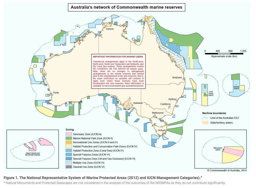
Australia’s offshore Marine Parks network spans approximately 3.8 million square kilometres, covering nearly 43% of the country’s Exclusive Economic Zone. This network includes a wide range of habitats, from shallow coastal reefs to deep mesophotic and abyssal environments. Mesophotic zones, typically between 30 and 150 metres depth, are of particular interest due to their ecological importance and limited accessibility using conventional survey methods.
In collaboration with Parks Australia and the NESP Marine and Coastal Hub, IMAS researchers have used Boxfish ROVs to conduct surveys across several Marine Parks, including Huon, Freycinet, Zeehan, and Beagle Marine Parks. These surveys focus on collecting high-resolution imagery to identify and quantify key components of reef ecosystems, such as habitat-forming sponges, black corals, macroalgae, and associated fish assemblages.
The data collected through these ROV surveys feeds directly into Australia’s Marine Park management framework, supporting zoning decisions, assessments of ecosystem condition and trends, and evaluation of conservation effectiveness.
From Imagery to Decision-Ready Data
The Boxfish ROV’s ability to hover precisely and navigate complex terrains enables targeted exploration of steep walls, boulder fields, and canyon systems, areas that are typically undersurveyed due to technical constraints. ROV footage is annotated using advanced tools such as Squidle+, allowing researchers to classify habitats and species and build robust datasets for ecological modelling.
By leveraging platforms like Squidle+ and Seamap Australia data portals, the IMAS team ensures that collected imagery, habitat classifications, and model outputs are openly available to researchers, marine park managers, and policymakers. This transparency supports comparative studies, long-term monitoring programs, and evidence-based conservation planning.
Technology Supporting Monitoring in MPAs
The Boxfish ROV’s compact form factor, long deployment duration (up to 15 hours), and high-resolution imaging capabilities have made it a valuable tool for marine biodiversity research in protected areas. Precise control and the ability to hover in place allow detailed visual surveys in sensitive habitats, reducing the risk of disturbance. Its flexibility enables missions that are otherwise logistically complex or cost-prohibitive.
By expanding access to deep, remote, and data-poor environments, Boxfish ROVs enable researchers to increase survey coverage, improve detection of rare species, and collect consistent datasets that support long-term ecological monitoring. These capabilities are particularly important in MPAs, where management decisions depend on reliable evidence and minimal environmental impact.
More About Boxfish ROV for Marine Science
Known for its exceptional image capabilities and stability, the Boxfish ROV features a high-resolution 4K live camera feed that can be streamed on a larger screen of a research vessel, allowing scientists to discuss data in real time. The Boxfish ROVs can capture environmental data along with uncompressed, stabilised 4K video and 20MP RAW photos for excellent photogrammetry models from the depth of up to 1,000 meters. It is easily deployable from research vessels, platforms, small boats, or even ice, providing excellent accessibility for scientific groups. With its 6DOF and exceptional manoeuvrability for sample collection and a flexible for additional sensors integration robust design, the Boxfish ROV is perfect tool for diverse scientific applications.
-
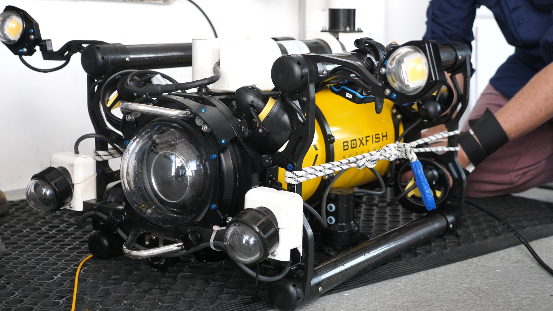
 Customised Boxfish ROV configured with two additional stereo camera systems for fish surveys. Credit NESP-IMAS
-
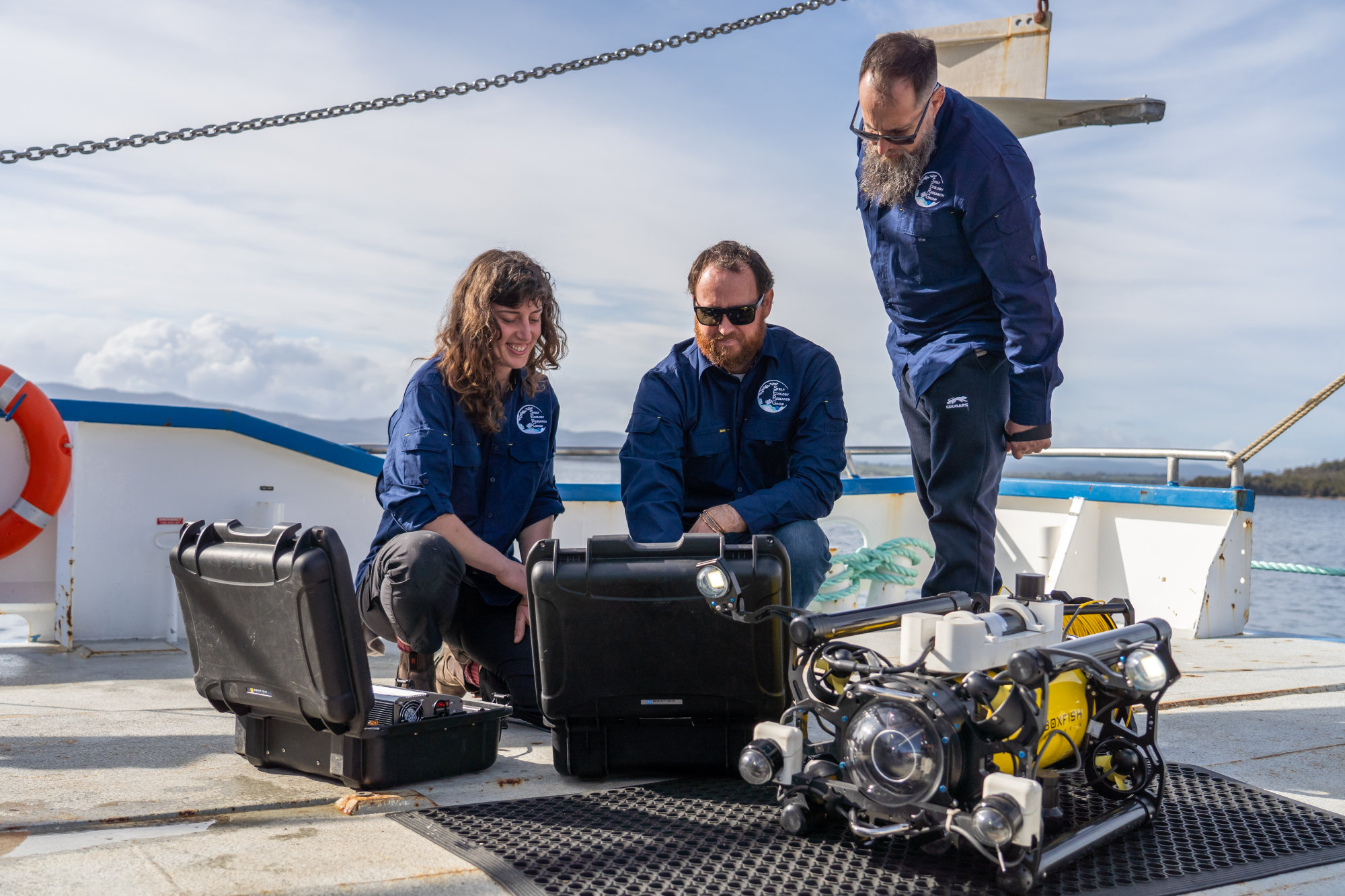
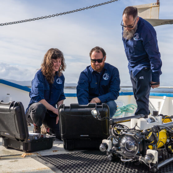 UTAS IMAS preparing and connecting the Boxfish ROV before deployment from a research vessel. Credit NESP-IMAS
-
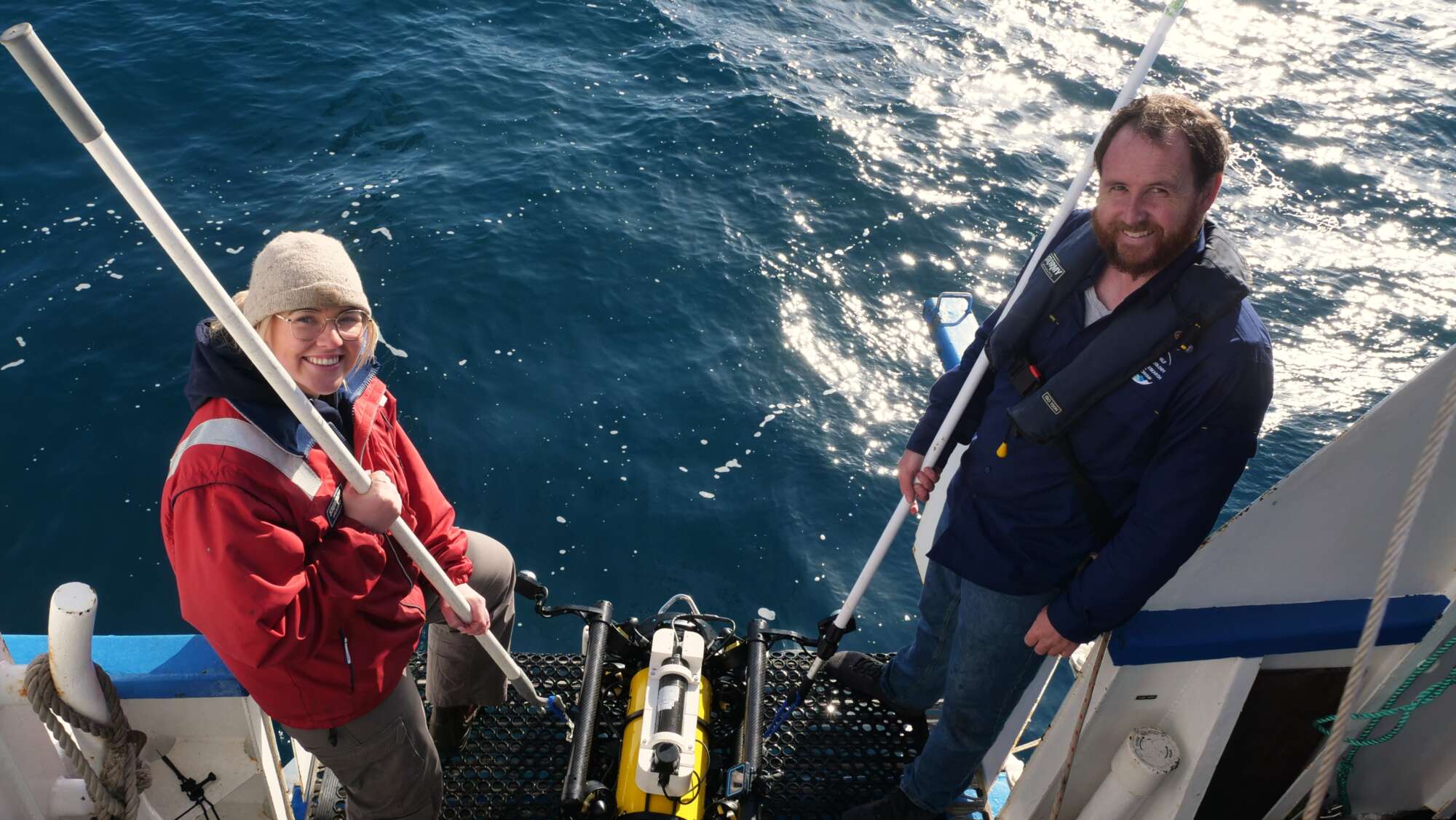
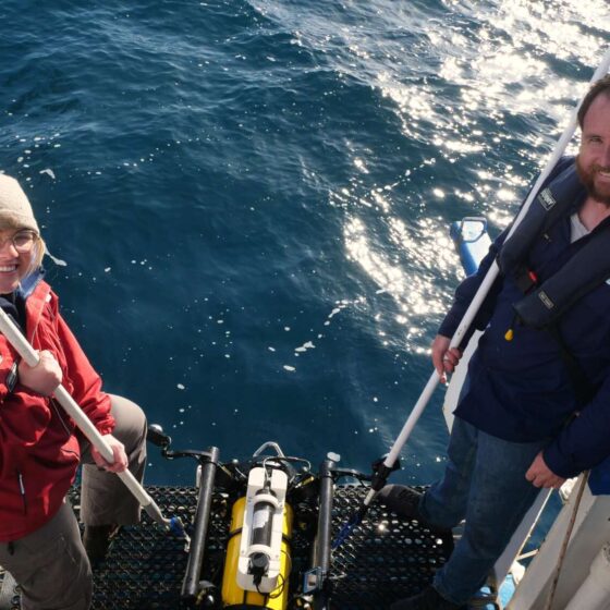 Boxfish ROV deployment from a research vessel without specialised launch or recovery equipment. Credit NESP-IMAS
-
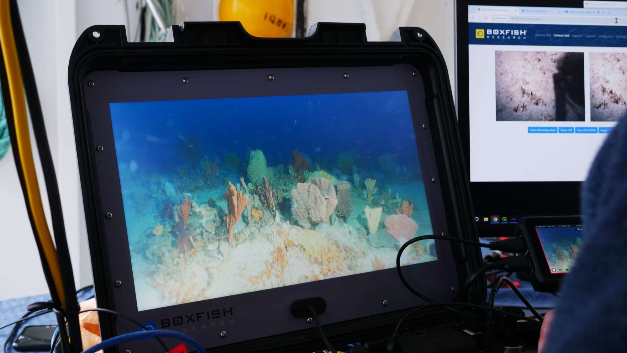
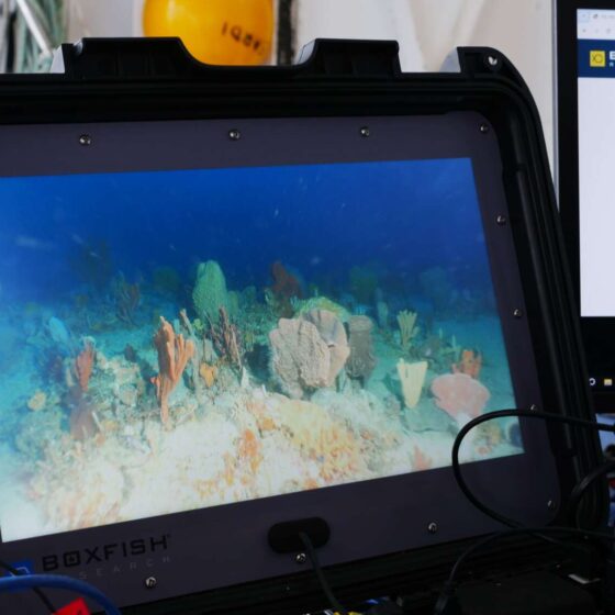 Sponge garden observed from the surface during Boxfish ROV deployment. Credit NESP-IMAS
-
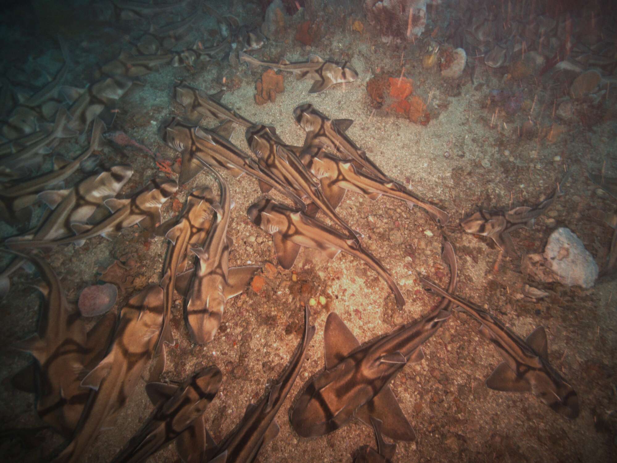
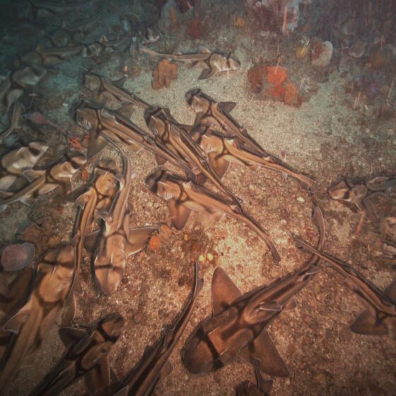 Port Jackson sharks on the seabed. Credit NESP-IMAS
-
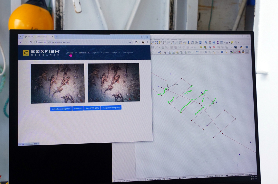
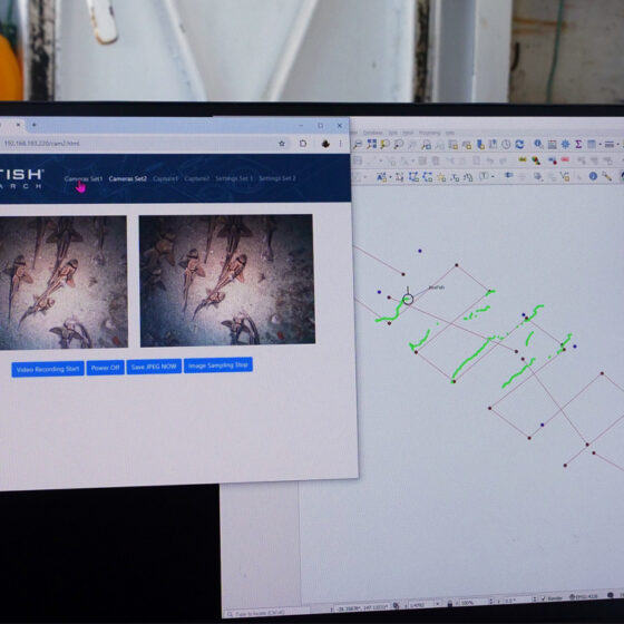 Port Jackson sharks observed from the surface during Boxfish ROV deployment. Credit NESP-IMAS
-
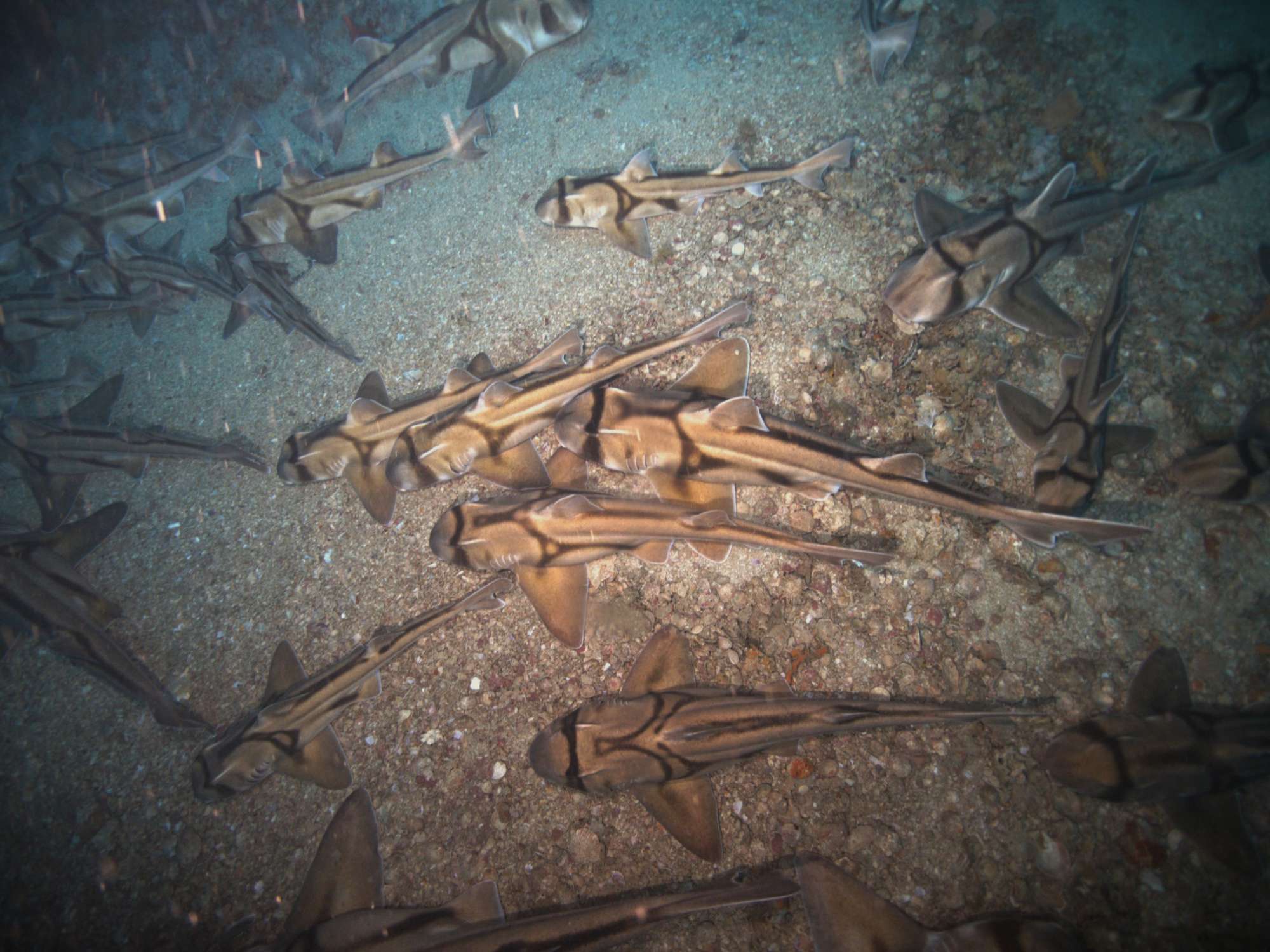
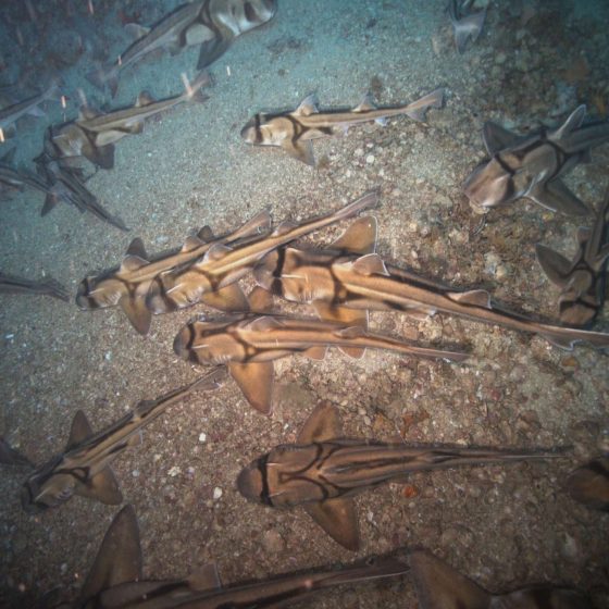 Beagle Marine Park appears to be an important area for Port Jackson Sharks. Credit NESP-IMAS
-
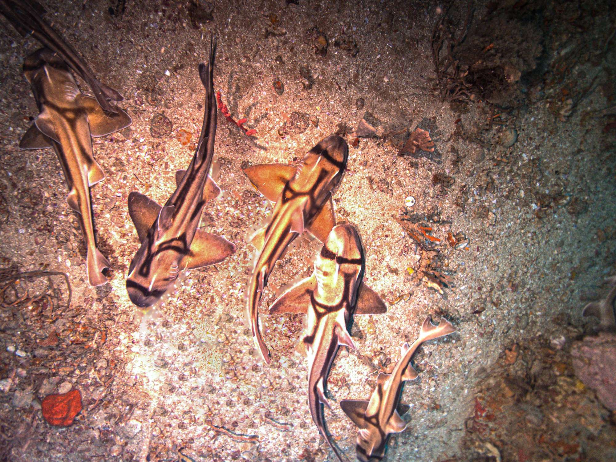
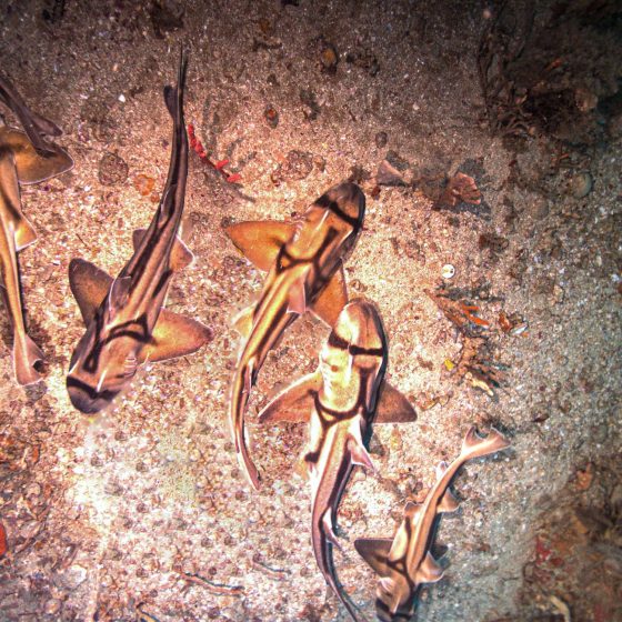 Port Jackson Sharks grow to 1.65 metres in length. Credit NESP-IMAS
-
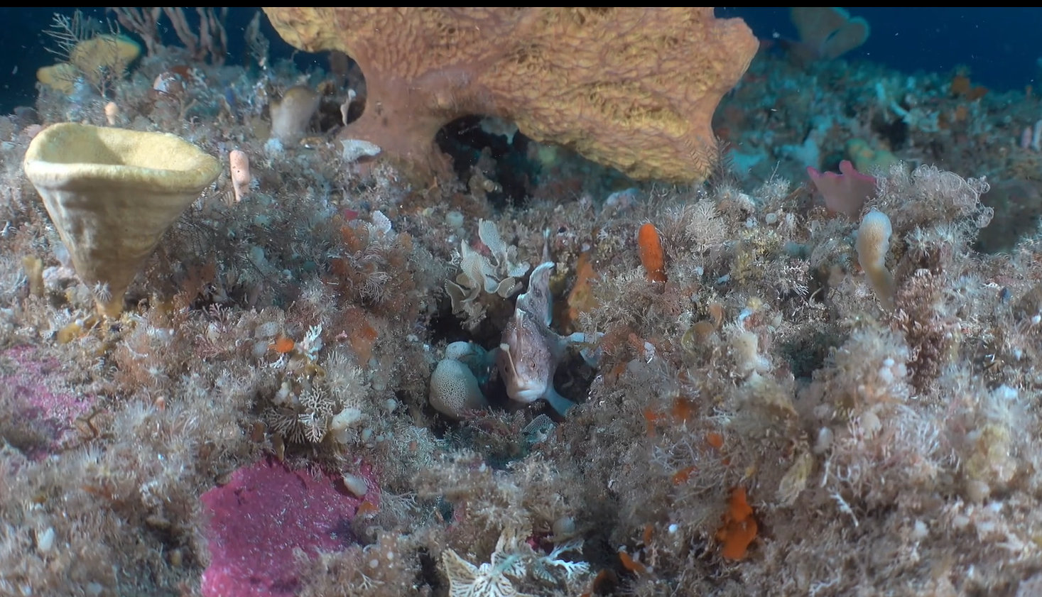
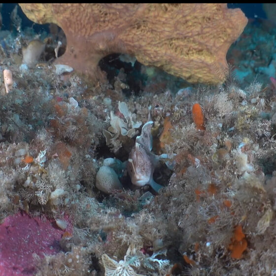 Pink Handfish captured during targeted visual surveys using a Boxfish ROV in Huon Marine Park. Credit NESP-IMAS