Environmental monitoring of marine and coastal environments often requires access to depths and conditions that exceed safe or practical limits for scientific diving. For environmental consultancies operating across sensitive habitats, ports, and offshore environments, maintaining data quality, repeatability, and safety is critical.
Leaf Global Environmental Services PLC (LGES), a Saudi‑based interdisciplinary environmental consultancy, integrates the Boxfish Alpha ROV into its marine survey workflows to extend environmental monitoring capability beyond diver‑safe depths. While using the Boxfish Alpha, LGES maintains the level of scientific control required for defensible environmental assessments. The company founded in 2018 with a strong focus on environmental stewardship. As a contributor to the Saudi Green Initiative (SGI), LGES supports sustainable marine and coastal development by safeguarding sensitive ecosystems and enabling responsible project delivery.
The LGES Marine Department brings together marine scientists, oceanographers, engineers, and certified scientific divers with extensive field experience. Their work spans coral reef transplantation and restoration, benthic and seagrass habitat assessments, marine ecology and monitoring surveys, protected species observations, and advanced marine data acquisition using ROVs and remote sensing technologies.
Key Challenges in Marine Environmental Monitoring
Many of LGES’ environmental monitoring projects extend into depth ranges where traditional scientific diving becomes constrained by safety limits, bottom time, and operational risk. At the same time, these projects require structured, repeatable survey methods capable of producing high‑quality visual data suitable for habitat mapping, baseline definition, and regulatory reporting.
Key challenges included:
- Extending surveys beyond diver‑safe depths without compromising data quality
- Maintaining stable, controlled visual transects in variable currents
- Ensuring positional awareness and consistency during habitat assessments
- Integrating visual data into GIS‑based environmental workflows
- Deploying and recovering survey equipment efficiently from relatively small vessels
How Boxfish ROV Improves Marine Environmental Monitoring Capability
H&S in Environmental Monitoring Operations
Since acquiring the Boxfish Alpha ROV, LGES has extended its environmental monitoring into areas where scientific diving alone is limited by depth, currents, and nearby infrastructure.The ROV enables work up to 300 meters beyond diver‑safe depths while maintaining direct scientific control, supporting structured surveys without increasing risk to personnel.
Standardised Video Transects for Habitat Assessment
Using the Boxfish Alpha ROV allows LGES to conduct video transects surveys with improved the consistency and comparability of seabed observations, supporting clearer identification of habitat transitions, substrate types, and biological features. This has enhanced the spatial context of habitat mapping outputs and reduced uncertainty during post-survey analysis.
Supporting Diverse Environmental Monitoring Objectives
The Boxfish Alpha ROV has already demonstrated tangible value across multiple survey applications, including benthic habitat characterisation, coral condition and health assessments, and surveys adjacent to marine infrastructure
Boxfish Alpha ROV provides an effective solution for transitional depth ranges, where diver based surveys become constrained by safety and efficiency considerations, and where larger deep water ROV systems may be operationally or economically impractical.
Evangelos Papadimitriou, Oceanographer | MSc | MBA, Marine Operations Manager – LGES
Practical Deployment from Small Survey Vessels
The Boxfish ROV is also practical to deploy from the small to medium vessels typically used by LGES. Its stability in variable currents and overall robustness support reliable data collection across a wide range of site conditions.
Cost-Effective Monitoring in Transitional Depth Zones
By using the ROV alongside scientific diving and other in‑situ measurements, LGES is able to bridge the gap between shallow‑water surveys and deeper environmental monitoring. This combined approach improves spatial coverage, reduces risk to personnel, and supports the collection of consistent, defensible datasets for environmental assessment and long‑term monitoring.
Supporting Defensible Environmental Reporting
The ability to collect high‑quality visual data in areas not safely accessible to divers has strengthened baseline habitat characterisation and reduced uncertainty during post‑survey analysis. As a result, environmental assessments are supported by more coherent spatial datasets and a stronger visual record, improving confidence in reporting to regulators, clients, and stakeholders.
Operational Outcomes of Integrating ROV Surveys into Environmental Monitoring
Integrating the Boxfish ROV into LGES’ survey workflows has strengthened key stages of environmental monitoring, from planning and fieldwork to data collection and reporting. By combining scientific diving observations, direct environmental measurements, and continuous geo-referenced ROV video transects, LGES can carry out surveys in a more structured and efficient way.
This integrated approach helps reduce vessel time, improves coordination between field teams, and supports faster decision-making during operations. Survey plans can be adjusted in real time using live visual feedback, allowing effort to be focused where it provides the greatest scientific or regulatory value.
The Boxfish Alpha ROV functions as a core survey instrument, supporting defensible environmental assessments, efficient field operations, and informed technical decision-making throughout the full survey lifecycle.
Evangelos Papadimitriou, Oceanographer | MSc | MBA, Marine Operations Manager – LGES
From a reporting perspective, the availability of continuous visual records alongside quantitative environmental data increases confidence in assessment outcomes and strengthens the evidence presented by LGES to regulators, clients, and project stakeholders.
-
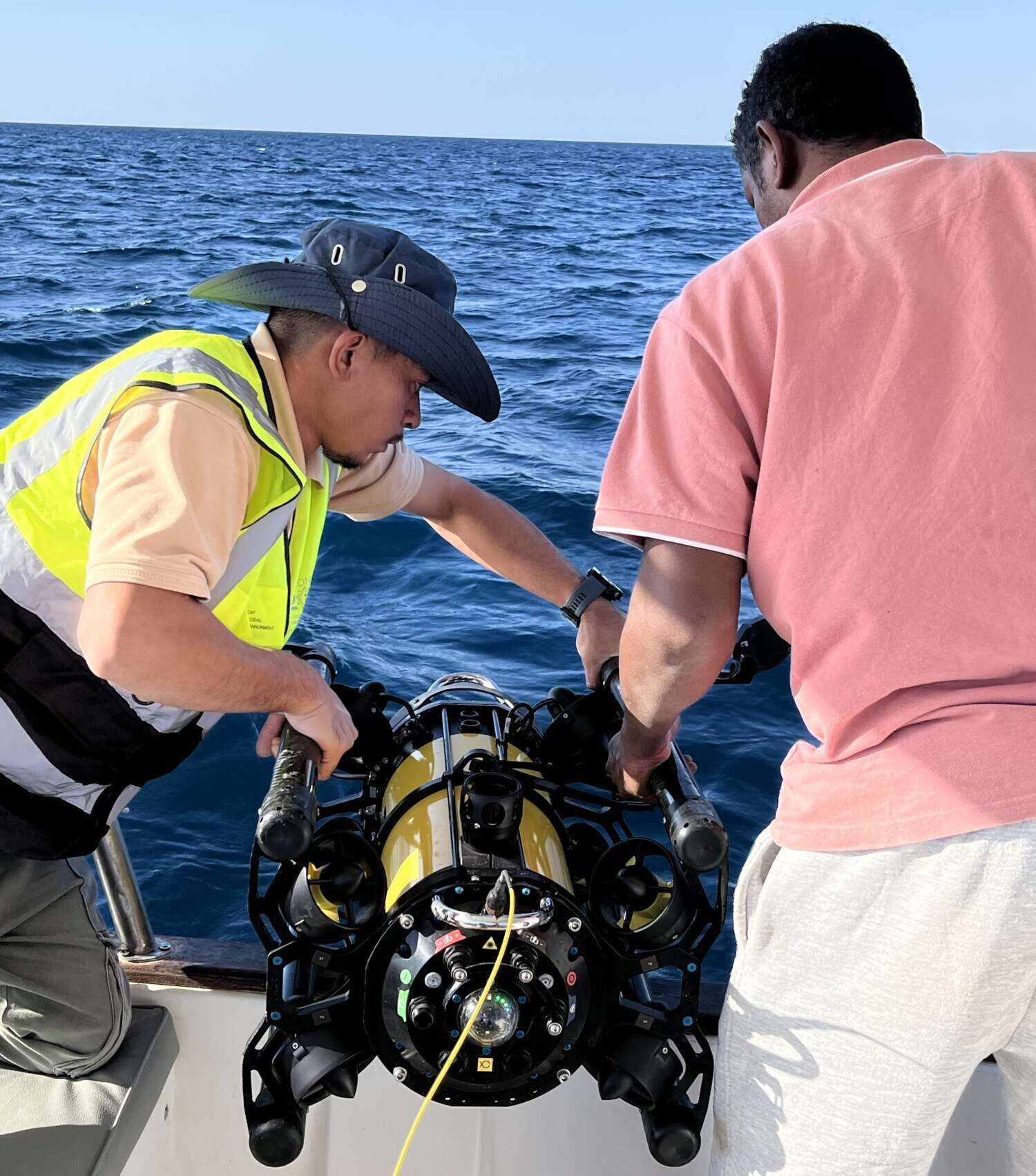
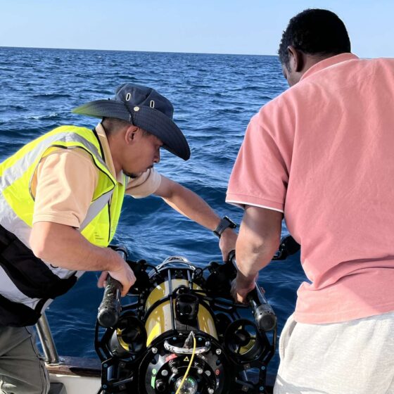 The Boxfish Alpha ROV can be deployed and recovered without any additional equipment, keeping operations simple and efficient.
-
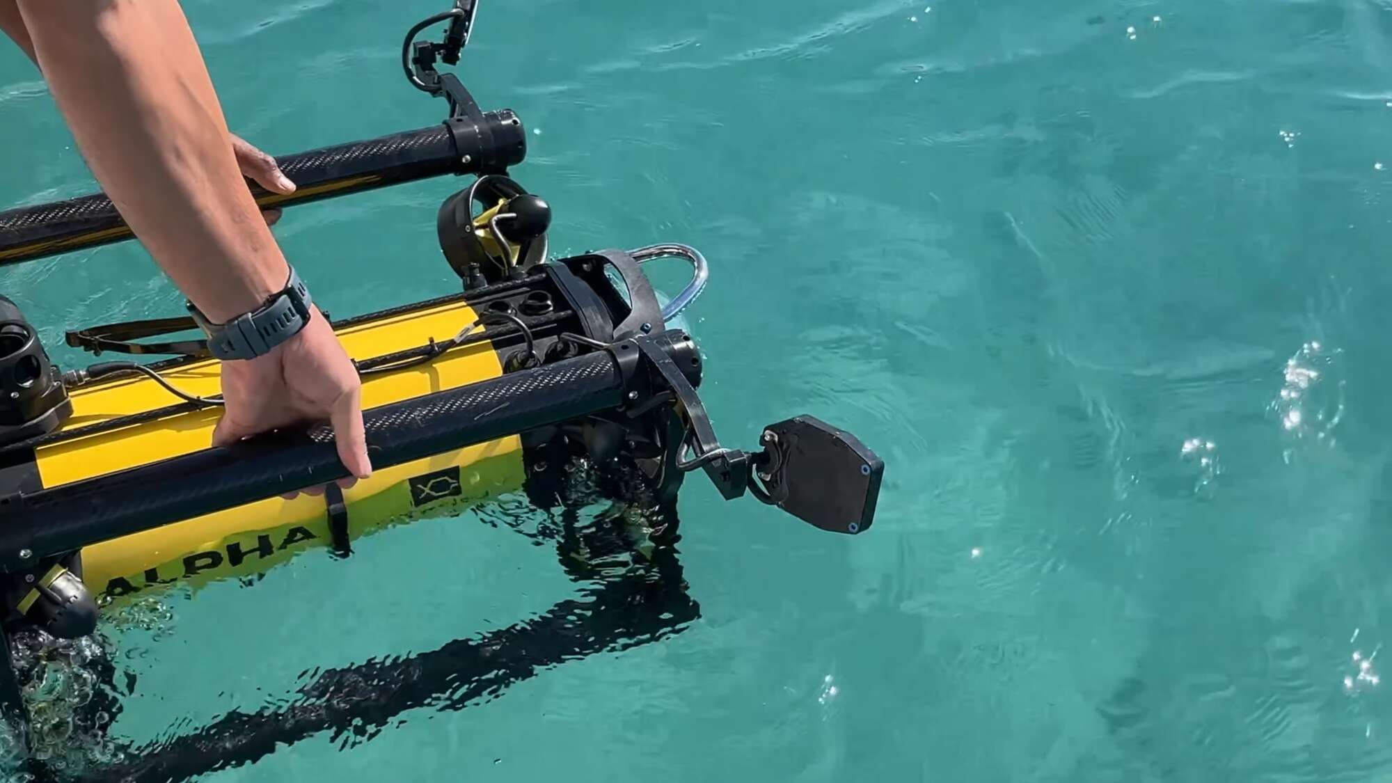
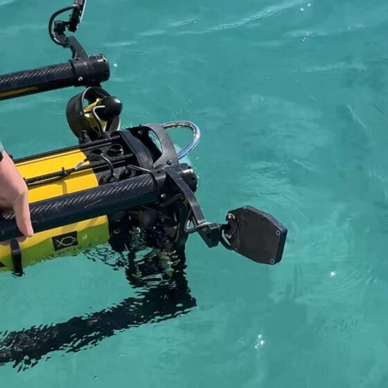 Deployment of the Boxfish Alpha ROV from LGES’s vessel.
-
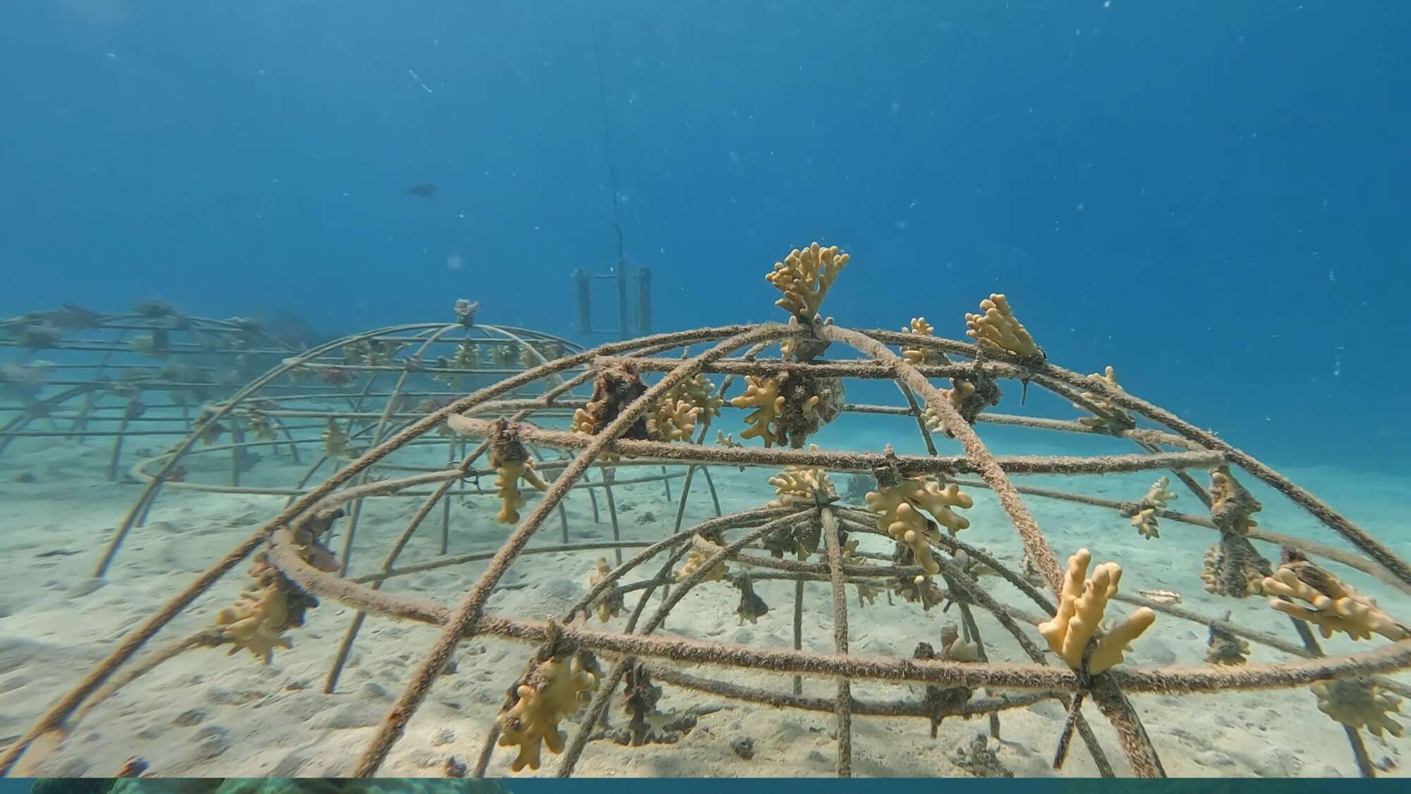
 A coral garden documented by the Boxfish Alpha ROV.
-
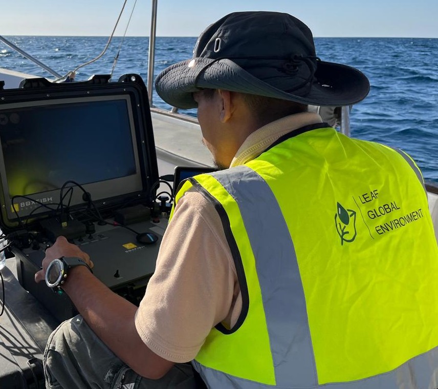
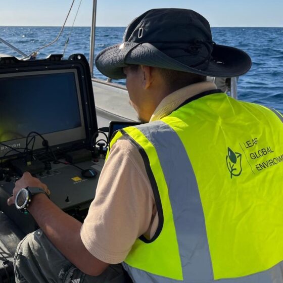 LGES’s ROV pilot monitors the live feed from the Boxfish ROV console.
-
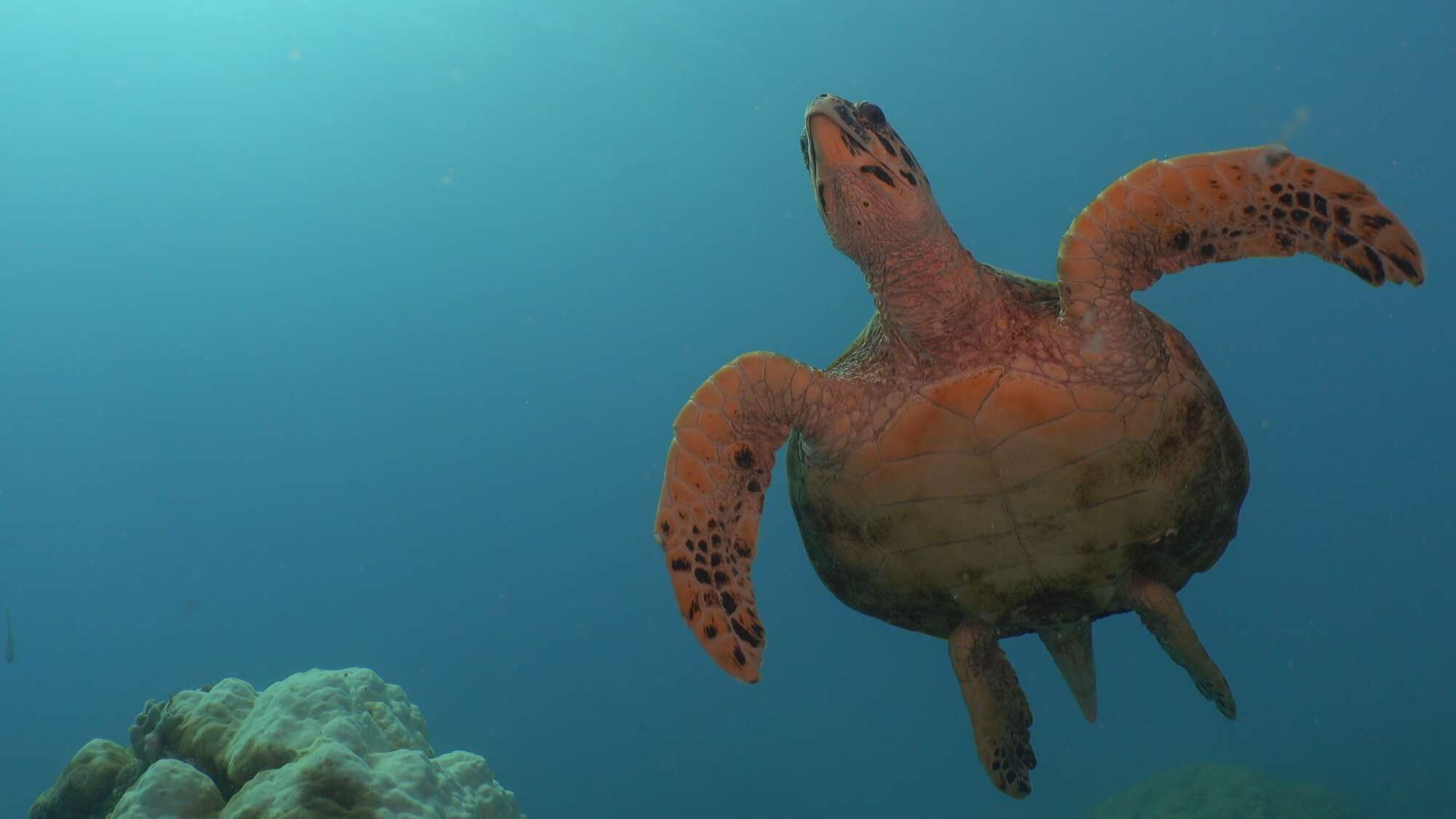
 A turtle captured by the Boxfish Alpha ROV during LGES’s deployment.